


What Is Underwater Research?
The BlueTrend team has been conducting ecological surveys at the Chao-jing Bay Aquatic Plants and Animals Propagation and Conservation Area in Keelung (hereinafter referred to as the Chao-jing Reserve) in recent years. The primary goal is to quantify ecological changes in Chao-jing since the establishment of the marine protected area (MPA) through a variety of survey methods. Research approaches can be broadly divided into quantitative and qualitative survey methods. Here is a brief overview of the differences between the two.
Quantitative surveys in marine research involve the use of data and statistical methods to measure marine phenomena and the relationships between variables — such as fish populations, biomass, and water quality indicators. Qualitative surveys, on the other hand, focus on exploring the deeper meaning and context of marine-related phenomena, collecting textual and visual data through interviews or observations to understand community perceptions of and behavior toward the marine environment. The two methods complement each other and together provide comprehensive insights into marine research.
Quantitative Survey:
Studying changes in fish and invertebrate communities within the Chao-jing Reserve. Through quantitative surveys, researchers can conduct field sampling to count the number and biomass of various fish species, and analyze the potential effects of different factors — such as human activity, water temperature, salinity, and pollutants — on the structure of fish communities.
Qualitative Survey:
Through participation in the spirit of citizen science, visitors and divers at the Chao-jing Reserve are encouraged to upload photos of the biological species they encounter, maximizing the collection of marine life observed within the bay. For example, the Japanese eagle ray documented in 2022 marked the first-ever underwater record of the species in Taiwan — an extraordinarily valuable finding.
What we carried out this time was a quantitative biological survey within the bay, collecting data on fish, invertebrates, and substrate respectively, with statistical analysis to be completed by year's end. This allows us to understand the year-on-year changes since the reserve was established. In particular, this year's abnormally high sea temperatures and the crowd control measures implemented at Chao-jing are environmental factors that could lead to ecological changes — and it is precisely through "data" that such changes can be objectively revealed.
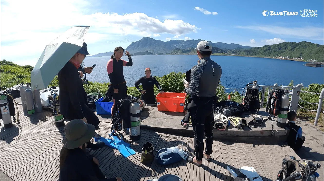
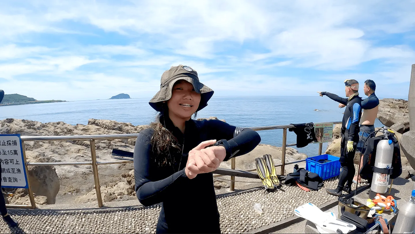
Completing the dive group briefing before entering the water
Defining the Survey Methods
The most important aspect of quantitative research is establishing a fixed survey methodology. In addition to keeping survey sites, survey times, and frequency consistent, the team has been continuously monitoring several sites within the Chao-jing Reserve and Shen-ao Reserve since 2015, building a long-term dataset.
Transect Lines: At each survey site, the team sets up 3 transect lines of 30 metres each, maintaining a consistent depth throughout data collection. Substrate quadrat frames are placed every 5 metres along the transect line to photograph the substrate environment.
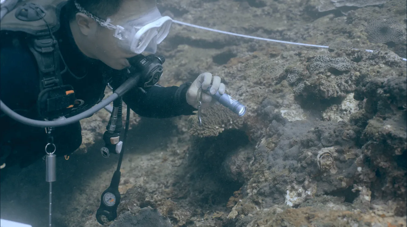
A researcher conducting an invertebrate ecological survey
Fish: Research team members move along the transect line and record the species and quantities of fish appearing within 1 metre on either side of the line. This is an extremely demanding task, as researchers who can identify species directly underwater in Taiwan are genuinely rare. As a result, some teams now record footage via GoPro and return to the lab for identification.
Invertebrates: Research team members move along the transect line and record the species and quantities of invertebrates appearing within 1 metre on either side, including triton's trumpet snails, sea urchins, sea cucumbers, lobsters, slipper lobsters, and certain shrimp species. These are all indicator species that reflect whether an area is under pressure from human harvesting and the level of biodiversity.
Substrate: Research team members move along the transect line, placing quadrat frames on both sides every 5 metres and photographing them for the record. By analyzing the distribution within the frames back in the lab, we can understand the distribution of algae, sandy substrate, and coral in that marine area. When algae-eating fish (such as parrotfish) decline due to human fishing, algae proliferates significantly, reducing coral coverage.
Common Survey Mistakes to Avoid
Fish and invertebrate identification genuinely depends on the underwater identification skills of the survey team members. If a species truly cannot be identified in the moment, the standard practice is to photograph it and consult an expert after surfacing (laughs).
The most common NG situations we encounter that can be corrected on-site mainly involve the placement of substrate quadrat frames. If frames are placed incorrectly, it makes downstream data processing difficult or creates gaps in the data, directly affecting the final research outcomes.
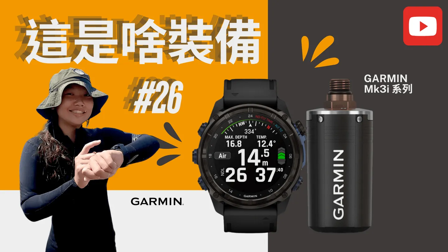
How the GARMIN Mk3i Enhances Dive Safety
The GARMIN Mk3i series dive computer paired with the T2 transmitter became a benchmark in dive computers from the moment it launched. Its exclusive patented SubWave sonar technology not only enables underwater message transmission but also simultaneously monitors the pressure gauge (SPG) readings and depth of up to 8 dive buddies. For a research team, this capability significantly boosts safety. We'll use real examples from this research dive to illustrate the practical applications.
Lost Your Buddy? Can't Find the Survey Site?
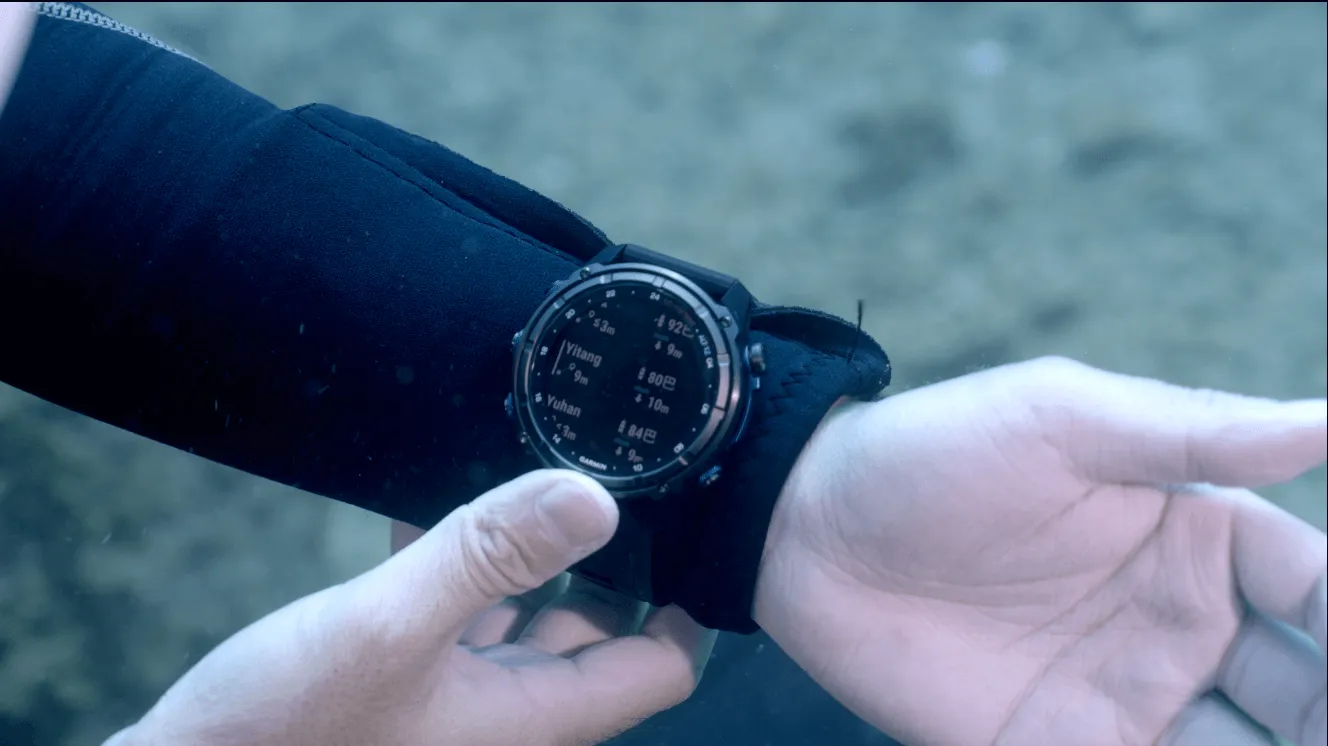
During this research dive, one of our team members forgot the location of the survey site and became separated from the main group. Using the GARMIN Mk3i's 2024 updated features, she was immediately able to see the horizontal distance between herself and all her dive buddies, as well as everyone's depth. Armed with this practical information, she was able to combine it with terrain navigation to locate her teammates with ease.
For example, if you know the cliff wall is on your left, your current depth is 10 m, it's shallower to the left and deeper to the right, and the watch shows your buddy is at 8 m — you can move toward the shallower area on the left, then use the horizontal distance reading to determine whether to go forward or back. This provides an extremely useful reference for locating a lost buddy, and is far safer than the old approach of searching blindly in open water.
How Do You Communicate Without Hand Signals?
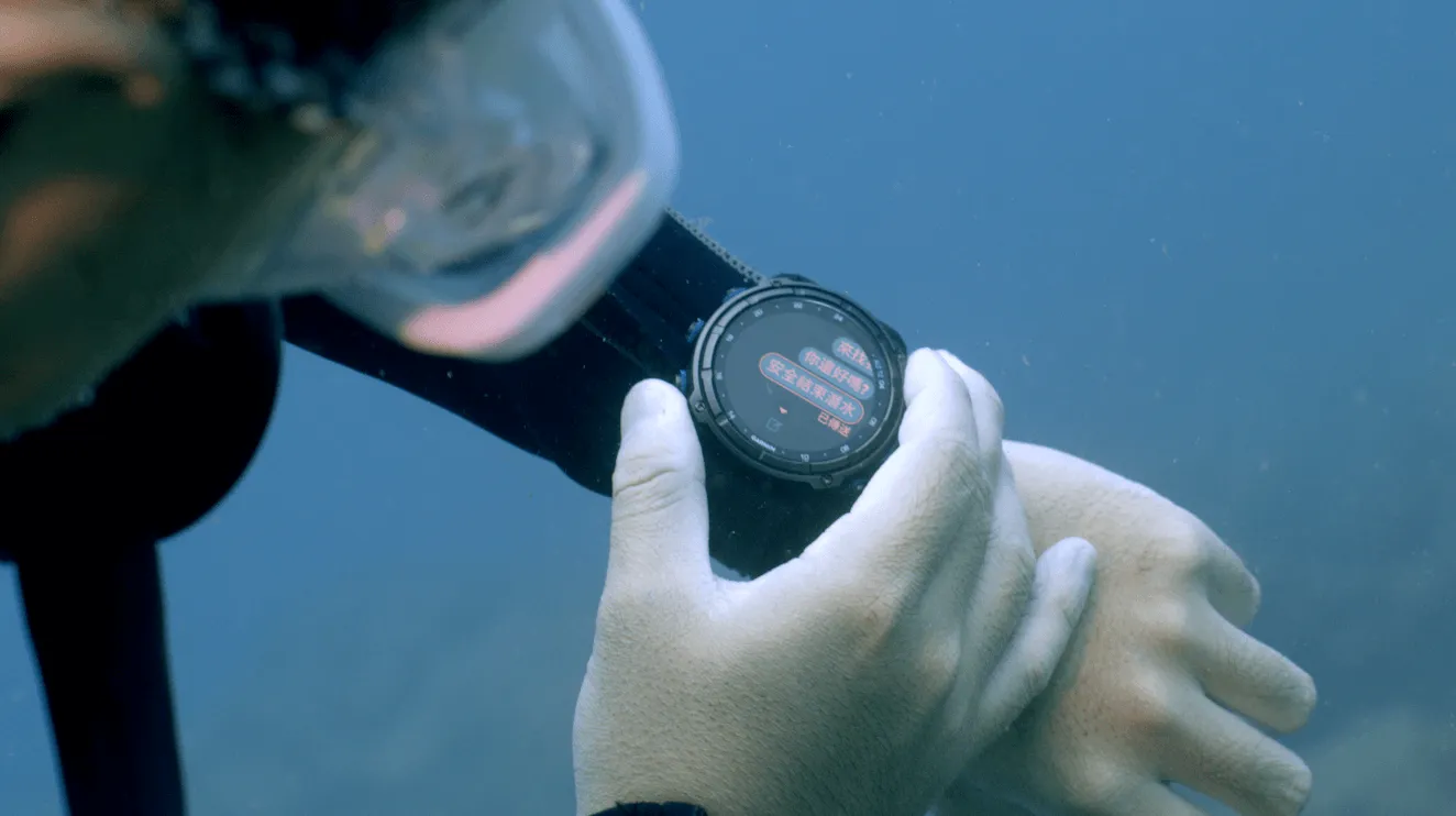
Visibility on the Northeast Coast is often only 3–5 m, and it's common to find yourself alone during underwater research — sometimes with team members spread across opposite ends of a transect line. When an urgent situation arises or a survey is complete and it's time to ascend, you used to have to track down all your dive buddies before you could communicate via hand signals. With the GARMIN Mk3i, you can now use the underwater messaging feature to communicate quickly and efficiently. The one drawback is that the GARMIN Mk3i currently only supports preset canned messages, and the selection is fairly limited. We hope that future updates will expand the number of preset messages and perhaps even allow users to customize their own.
No More Lying About Your Air!
Many dive instructors will be familiar with this scenario: you turn to a student and ask how much air they have left, and they say 100 bar — similar to your own — so you continue the dive without concern. Then, back on the surface when you check everyone's pressure gauge (SPG), everyone has around 60 bar left, except for that one student who is down to 20 bar. This is a very common form of air misreporting among beginners. With the GARMIN Mk3i, the pressure gauge (SPG) readings of every dive buddy in the team are visible at a glance, making it impossible to misreport air.
During research or filming projects, it's easy to become so focused on the task at hand that you neglect your air supply. If the team has a designated safety officer, they can monitor everyone's pressure gauge (SPG) at any time, raising the overall level of safety.
How Far Can the SubWave Sonar Transmit?
Everyone is curious about the actual transmission range of SubWave sonar technology in real-world conditions. During this research dive, we found a flat, open area with no obstructions along a straight line and conducted a proper test. Buddy pressure gauge (SPG) monitoring, horizontal distance, and depth detection cut out at approximately 27 m, with the last received message coming from a distance of 24 m away.
According to GARMIN's official website, the monitoring function has a range of 10 m, while messages can be transmitted up to 30 m. Based on our actual six months of real-world use, the effective range for both monitoring and messaging varies each time. We suspect this is because the SubWave sonar technology radiates outward from the T2 in a 360-degree spherical pattern, meaning that any obstruction between dive buddies will reduce transmission efficiency and range.
Is the Transmitter Actually Useful?
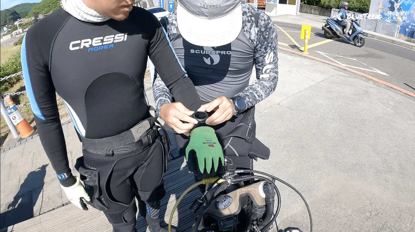
Understanding your gear's features before entering the water is essential
This is a question the Editor gets asked often by fellow divers on every dive. Some people feel that even with a transmitter, you still need a pressure gauge (SPG) as a backup for safety — so isn't the transmitter redundant?
But based on my own experience using it for over a year, the convenience the transmitter brings can only be summed up in one sentence: "Once you've used it, there's no going back." During a dive, we're often scanning the water column for marine life, and constantly having to look down to check a pressure gauge (SPG) becomes a real inconvenience. When we raise the camera and focus on filming, all it takes is a slight twist of the wrist to check the reading on the watch face — meaning we don't need to interrupt filming at all.
Does the transmitter have drawbacks? Of course every product has its shortcomings. Some people can't tolerate the sonar sound emitted by the transmitter (though the sonar intensity can be adjusted in the settings). As for the transmitter's battery — you absolutely must remember to remove it before every flight, and we've occasionally had the embarrassing experience of forgetting to bring spare batteries on an overseas trip.
For a groundbreaking product to truly make its mark, it must not only change existing user habits at its core, but more importantly, it must be built entirely around the needs of users. All things considered, the GARMIN Mk3i series dive computer undoubtedly fulfills both of those criteria.
the Editor's Team
Who Is the GARMIN Mk3i Best Suited For?
Based on the hands-on experience of the Editor's team, the GARMIN Mk3i is an excellent fit for "team" use — for example, research teams, photography teams, or regular groups heading on domestic or international dive trips together. Because every member of the team can monitor each other's dive status at any time, acting as a mutual reminder system, dive safety levels rise organically without anyone having to think about it.
We also look forward to GARMIN expanding the range of applications built around the existing SubWave sonar technology — such as customizable text messages, deeper integration with more GARMIN products, and the gradual construction of a GARMIN dive product ecosystem that fundamentally transforms the diving experience.
Related Links
- GARMIN Mk3i Official Website
- GARMIN Dive Watch New Product Launch — MK3 New Features: Flash Light and Messaging? We Unbox It Underwater
- GARMIN Mk3i + T2 Transmitter — The World's Strongest, Now Even Better! Underwater Messaging and Pressure Gauge (SPG) Monitoring Solution
Further Reading