


After exploring the dive sites covered in Taiwan Diving Environment Overview – Northern Taiwan and Taiwan Diving Environment Overview – Southern Taiwan, it's time to venture even further afield. This time we'll introduce the outlying island dive sites of Green Island, Orchid Island, and Penghu. Because transportation to these destinations is less convenient, the Editor's reach is limited — so we sincerely hope readers can help us fill in the details on dive sites and dive shops. Your contributions are more than welcome!
Green Island
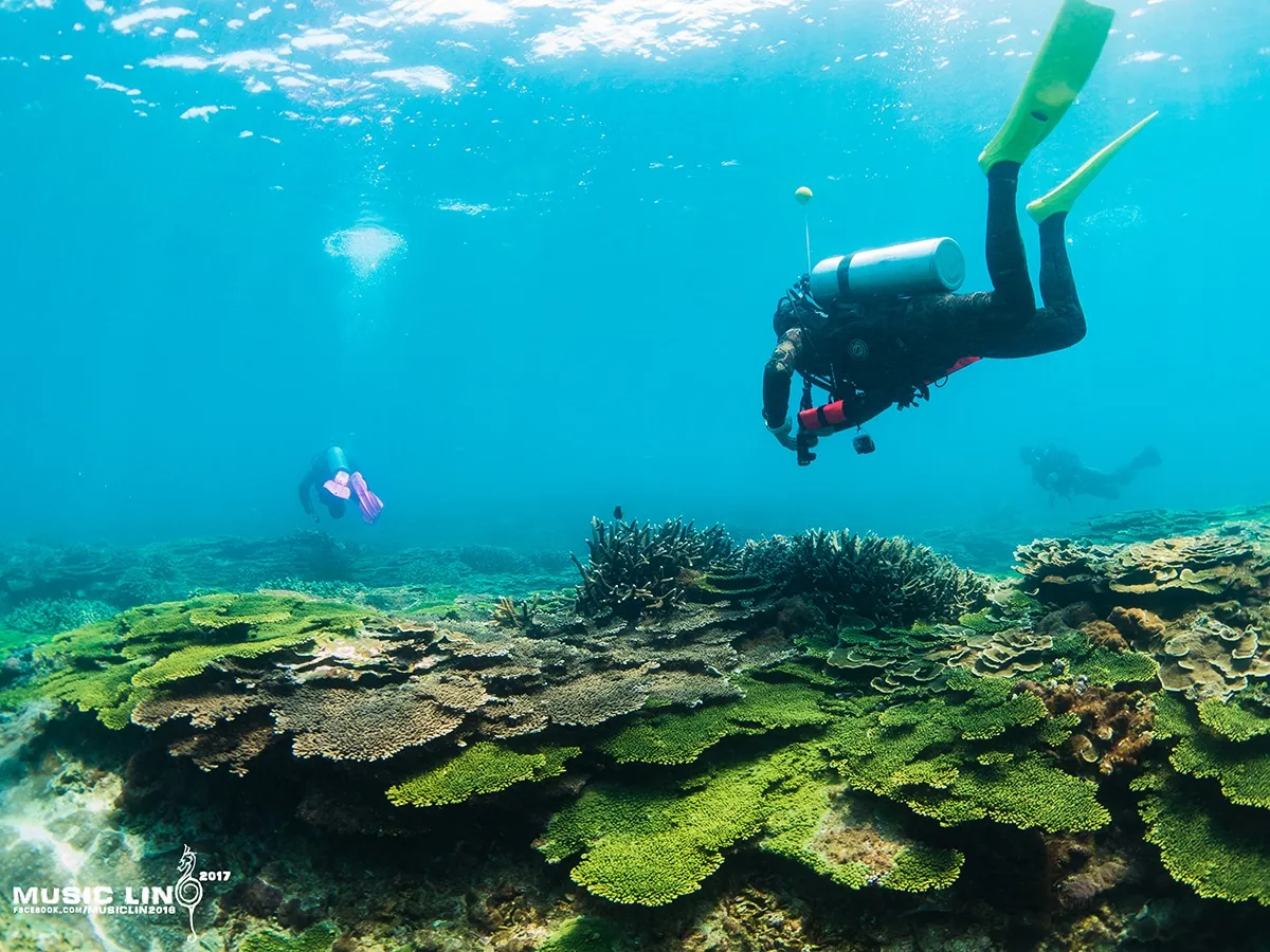
Green Island is renowned for its world-class visibility. Photo Credit 揪潛水同學會
Green Island lies in the Pacific Ocean to the southeast of Taiwan. The island has an irregular quadrilateral shape, covering approximately 16 square kilometres, making it Taiwan's fourth-largest island. Coral reef formations encircle the island, supporting a rich underwater ecosystem. Situated within the path of the Kuroshio Current, the water temperature stays above 20°C year-round — around 22°C at its winter minimum and up to 30°C in summer, with an annual average of around 25°C. This warm water is ideal for coral growth. Because the island's remote location requires a ferry or flight to reach, human impact is reduced, and underwater visibility typically ranges from 30 to 40 m, making it an excellent destination for dive travel.
During summer when the southwest monsoon prevails, the southwestern waters of the island are most affected; in winter when the northeast monsoon dominates, diving on the northeastern side is generally not recommended. The typhoon season in summer also warrants extra caution — not only does visibility deteriorate after a typhoon, but driftwood accumulating in the harbour can lead to the island being cut off for up to a week. This should be factored carefully into any dive travel plans.
Tidal range around Green Island is generally small, but the interplay between the island's shape, coastal currents, and the Kuroshio creates complex current conditions. Divers should always listen carefully to the dive guide's briefing before entering the water and remain attentive to tidal changes throughout the dive. At certain sites, the temperature difference between high and low tide can reach as much as 5°C, and current speeds can vary significantly with the seasons. When diving at sites with dramatic wall formations such as the Grand Canyon or the Crack of Heaven, divers must watch for sudden downcurrents or upcurrents and maintain neutral buoyancy at all times to hold a steady depth.
With an average annual water temperature of 25°C, and the volcanic peaks of Huoshaoshan and Ameyshan sheltering the island from monsoon winds, there are suitable dive sites for both winter and summer. We recommend consulting your dive shop about current sea conditions and weather before planning your trip. The following dive sites are organised according to the fishery resource reserve zones designated by the Taitung County Government.
- Nanliao Zone: From Guiwan Bi northward to south of the airport. The Shilang Ecological Reserve sits at the centre of this zone, with coral coverage reaching 50% — making it the hub of snorkeling and ecotourism on Green Island. When the southwest wind blows in summer, waves can surge along the shore, so extra care is needed when entering and exiting the water.
Notable dive sites include: Airport Fault, Xichi Reef, Shilang Reserve, Large Mushroom, Pole Reef, Six-Meter Reef, Clownfish (Nemo) Island.
- Zhongliao Zone: From north of the airport to west of Guanmubi. The Chaikou Ecological Reserve within this zone is famous for its hard coral aggregations, with coverage reaching 75%. Guanmubi has the greatest diversity of nudibranch species of anywhere on the island. This zone is almost entirely unsuitable for diving in winter, which should be taken into account when planning your itinerary and choosing accommodation.
Notable dive sites: Suiyang Warship Reef, Zhongliao Harbour, Chaikou Reserve, Yanglao Reef, Fazi Reef, Guanmubi.
- Guanlan Zone: From east of Guanmubi to south of Guibei Bay. This area is characterised by mixed reef and gravel-beach topography, with well-developed volcanic rock formations and striking sea-erosion landscapes sculpted by wave action. Diving is also not recommended here when the northeast monsoon picks up.
Notable dive sites: Guanlan Outer Reef, General Rock, Crack of Heaven, Grand Canyon, Three Rocks, Loumen Rock Outer Reef, Nanzihu Outer Reef, Youzihu, Blue Cave, Gunshui Bi, Pegasus Wreck, Hot Spring Tower, Ziping Outer Reef, and others.
- Guiwan Zone: From north of the Dabaisha diving trail to south of the northern entrance of the Dage Tunnel. Although the coastline in this zone is short, it is the most frequently visited diving area on the island. The large gorgonian / sea fan field at the Dabaisha Independent Reef is its standout attraction.
Dive sites in this zone include: Guiwan White Whip Forest, Jizai Reef, Horseshoe Bridge, Church, Steel Reef, Dabaisha Independent Reef.
Orchid Island
Crystal-clear visibility and great depths are the hallmarks of Orchid Island diving.
Orchid Island's earliest name was Pongso-no-Tawo, meaning "Island of People." In the Hokkien dialect, a phonetic approximation gave rise to the name Hongtou Yu (Red Head Island). In 1946, the island was renamed Orchid Island (Lanyu) after the phalaenopsis orchids that grow abundantly there. Orchid Island lies to the southeast of Taiwan's main island and is the second-largest island in the Taiwan area after Penghu. A motorcycle circuit of the island takes about one and a half hours. The permanent resident population is approximately 5,000, and the island retains the rich, intact culture of the Tao (Dawu) indigenous people — a world apart from mainland Taiwan.
The best diving season on Orchid Island runs from March to September. Aside from summer typhoons, it is an excellent destination for scuba diving. Orchid Island is famous for its exceptionally high visibility — exceeding 50 m underwater — and, thanks to the Kuroshio Current, water temperatures remain between 21°C and 29°C year-round. However, due to the combined influence of the northeast monsoon and the Kuroshio, downcurrents are a well-known hazard at many Orchid Island dive sites. The stretch between Sìtiáogōu and the Old Man Rock is a renowned drift diving area. Sites such as Airport Outer Reef, Warship Rock, and Twin Lions Outer Reef also require close attention to sudden strong currents; boat captains should monitor conditions at all times and be ready to adjust the dive plan accordingly.
Orchid Island's dive sites are divided into four main areas based on the island's villages. Since the island is sizeable, travel time between dive sites should be factored into any dive plan. Choosing the right dive shop and transport arrangements will go a long way toward making your dive trip more comfortable.
- Hongtou Village to Yuren Village The nearshore area is mostly sandy, easily blanketed by southwest airflow that can deposit sediment over coral surfaces, resulting in a relatively featureless underwater terrain. However, as you move further offshore from Hongtou Harbour, the topography becomes progressively more varied. The Sìtiáogōu area features a prominent headland, with summer currents reaching 1–3 knots; downcurrents and upcurrents can form abruptly at rocky corners, and divers must exercise particular caution.
Notable dive sites: Badai Bay Wreck, Badai Bay Aquarium, and Airport Outer Reef.
- Yeyou Village This area is mostly a gravel and sand shoreline, though hard coral aggregations are present in notable numbers. Located on the southwest side of Orchid Island, this zone becomes the top choice for introductory and training dives once the northeast monsoon season begins. In some spots, steep topographic drops have given rise to impressive concentrations of hard coral and soft coral. Most of these dive sites lie close to the island-encircling road and are easily accessible as shore dives.
Notable dive sites: Blue Cave, Yeyou Fault.
-
Langdao Village Langdao Village sits on the northern side of the island, and most of its dive sites are located near the coastal road — making this the easiest area on the entire island to reach for shore dives. The nearshore seabed here is predominantly a fringing reef profile, with hard corals massing densely at depths of 3 m to 15 m and exceptional biodiversity. The varied topography, which sometimes requires divers to squeeze through reef crevices, is one of the area's defining characteristics. Key sites include Twin Lions, Hen Rock, and Jade Girl Rock. However, because this area faces the northern side of the island, diving here is not recommended after the northeast monsoon sets in.
-
Dongqing Village The dive sites here are known for dramatic undulating topography — at times the underwater landscape resembles a range of mountains, giving divers a breathtaking, open-sky sensation. Sites like Yongxing Reef feature dense aggregations of coral and fish, making them ideal for underwater photography. Yinyin Small Canyon and the Crack of Heaven reveal natural corridor formations worth exploring. However, all sites in this area involve significant depth, and boats typically do not anchor, which makes precise control of neutral buoyancy absolutely essential.
Penghu
A dive trip to Penghu is full of surprises. Photo Credit Music Lin
Penghu lies to the west of Taiwan's main island and is Taiwan's largest outlying island group. Volcanic basalt formations are found throughout, creating an underwater landscape unlike anything else in Taiwan. Year-round sunshine over the shallow coastal waters, combined with warm Kuroshio tributary currents, provides abundant nutrients for both soft coral and hard coral, in turn attracting rich aggregations of fish.
In recent years, the Southern Four Islands have been actively developed by the government into a national park. Under the close attention of the many people who care about ocean conservation, the ecosystem there is gradually recovering its former richness. The area is known as Taiwan's "seed bank," reflecting how well-suited the environment is to nurturing marine life. The Southern Four Islands encompass the main islands of East Yupingyu, West Yupingyu, Dongjiyü, and Xijiyü, along with 13 surrounding smaller islands.
Penghu is dominated by the northeast monsoon in winter (October through March of the following year) and the southwest monsoon in summer. The total number of strong-wind days reaches 223 per year, with only 132 days suitable for offshore activities. The recommended season for diving is July, August, and September — and even then, sea conditions before and after typhoons must be taken into account, leaving relatively few truly suitable diving days in Penghu each year. The annual average sea temperature is 23.7°C, ranging from approximately 12–26°C in winter and 23–31°C in summer.
Currents in the Penghu area are primarily influenced by the China Coastal Current and the Kuroshio. Unless extreme weather such as a typhoon or cold front occurs, currents flow steadily in a consistent direction. Particular attention should be paid to tidal changes: at certain locations the topography can generate sudden eddies, so divers should exercise caution and are advised not to dive during the peak of incoming or outgoing tides.
- Southern Four Islands – Dive Site Zones: Dongjiyü and Xijiyü
Dongjiyü is composed of basalt formations. Except for sandy beaches on either side of the harbour, most of the coastline consists of sea-cliff terrain — shore diving is not recommended here. Coral reefs extend around the entire island: the shallow flats on the eastern side offer calm waters suitable for snorkeling, while the northeast corner, close to a wave-cut platform, features rich topography and plentiful fish life ideal for recreational scuba diving.
Popular dive sites: Donggong Qian (East Palace Front), Daping Qian (Big Flat Front).
Xijiyü has coral reefs across its southern side. The waters feature abundant basalt formations interspersed with extensive fleshy soft corals in wreath-like arrangements, with fish weaving through them — making it a highly rewarding destination for a dive trip.
Popular dive sites: Huahuan Park (Wreath Coral Park), Xiji Castle.
- Xiji Fault – East and West Yupingyu Dive Zones
East Yupingyu is a basalt mesa (table mountain). The coral community is dominated by Acroporidae, Poritidae, and Pocilloporidae. The eastern side of the island features boulder reef and Five-Meter Reef formations, where rocky outcroppings rise from sandy flats in a varied and dynamic landscape. Currents are moderately strong, flowing from southeast to northwest. Sea-erosion gullies and caves are prominent features here, and fish life is abundant.
Popular dive sites: Tazai North, Laizaiwei, Five-Meter Reef, Boulder Reef, Zhongzai West, Erwen South.
West Yupingyu is a Penghu natural ecological reserve. Landing on the island and diving in the surrounding waters are prohibited. Nevertheless, its towering sea-cliff formations and the surrounding islets make it a truly worthwhile — and popular — dive destination. According to a 2009 survey report, West Yupingyu has the highest coral coverage of all the Southern Four Islands, resulting in a relatively rich coral ecosystem and marine biodiversity.
Popular dive sites: Ecology Corridor, Qingtian Rock, West Yupingyu North, Sandy Maze.
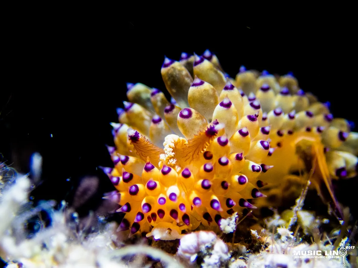
Penghu is also a fantastic destination for macro photography. Photo Credit Music Lin
Frequently Asked Questions
How is a BlueTrend dive trip different from a regular travel-agency dive tour?
Are there certification (C-card) level or logged-dive requirements to join a BlueTrend overseas dive trip?
Can I join as a solo diver? How is room arrangement handled?
Does the trip fee include dive insurance, gear rental, flights or instructor tips?