


Around mid-May, a phone call came out of nowhere asking whether I could teach a class at the Fushan Fisheries Resources Conservation Area in Shanyuan, Taitung on June 10, 2023. Just like that, I had landed an opportunity to be an instructor.
Hearing "Shanyuan, Taitung" brought back memories — I used to roam the East Coast as well. I thought back to my graduate school days, surveying shorelines all over Taitung, especially Shanyuan: leaping between massive boulders, recording target species. That was already more than ten years ago. After graduation, I never returned to the intertidal zones of eastern Taiwan. June 10 also jolted another memory — it marked the sixth anniversary of the crash that claimed the life of Director Chi Po-lin, whose documentary Beyond Beauty: Taiwan from Above captured Taiwan's environment for the world to see. Time moves so fast. Have we forgotten something? As those memories and feelings welled up, I took this opportunity to put them into writing.
Accepting the Assignment
It started like this: Coach A-Xian from BlueTrend (藍色脈動) — a marine media company dedicated to promoting the concept of marine citizen science — reached out and asked whether I could teach an intertidal survey training course organized by the Taitung District Fishermen's Association.
The moment I heard I'd be an instructor, my first thought was: "Wait… I have to get up in front of people and teach? Can I actually do this?"
As it turned out, the original invitation had gone to Li Cheng-Lu (Wox Lee), a naturalist with extensive field observation experience and author of Marine Natural History, who had to cancel due to a scheduling conflict.
BlueTrend asked Cheng-Lu if he could recommend someone to fill in. Without a second's hesitation, he said, "Just find Yan-Hui — he can do it!!"
Being recommended as an instructor was both flattering and daunting. I had never taught in front of a class before (even my experience as a teaching assistant amounted to little more than helping a professor with student affairs). I was upfront with A-Xian: while my research background is in marine invertebrate taxonomy, I'm much more at home indoors examining specimens under a microscope than identifying organisms in the field — nowhere near as experienced as Cheng-Lu in that regard.
But A-Xian reassured me: "Relax! We trust your expertise. Just teach based on your own knowledge and experience — we have a reference template you can use."
Those words put me largely at ease. Thinking it over, I also realized this was a once-in-a-lifetime chance to build my experience standing up in front of an audience. So I agreed to be the instructor for that day.
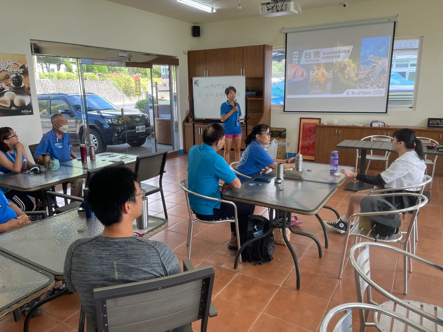
Coach A-Xian opened the session by introducing what a citizen scientist is and how surveys are conducted.
Preparing the Materials
Shortly after, A-Xian set up my profile and sent over the reference teaching materials.
"These are Cheng-Lu's intertidal teaching slides," he said. "I'll leave it to you to revise the text and content."
I opened the file to find slides filled with colorful hand-drawn illustrations of marine life, landscape photos, and snapshots of all kinds of organisms, along with a charming cast of illustrated characters — lively and engaging throughout. The content, however, was centered on the coastal environment and intertidal life of the Northeast Coast, so I would need to rework it into something suited to the intertidal zone around the Fushan area of Taitung.
That said, I had a nagging worry: "I don't have any of my own photos of intertidal life from eastern Taiwan — and I have no idea what species are actually found there!!"
I started by searching online for any intertidal survey reports on the Fushan Fisheries Resources Conservation Area. Using various keywords, I could only turn up a Survey of Fish Diversity in the Fushan Fisheries Resources Conservation Area — no invertebrate data to speak of. I then tried searching for general information about the reserve, and when I finally came across tourist photos of the interpretive signboards on-site, I could have cheered: "At last — some reference material on the local fauna!!"
From there, I began thinking through what I actually wanted to cover in the course. Looking at the nearly hundred slides of teaching material, I worried: would there be enough time? Would participants fall asleep? Could they absorb all of this? How could I present complex knowledge in a way that was clear and accessible?
As I mulled it over, I opened the slides and started revising them to reflect what I wanted to convey — and in studying the structure of the materials, I found they could naturally be organized into five chapters:
| Concepts | Observation | Outdoor Prep | Survey Methods | Species ID |
|---|---|---|---|---|
| Definition of the intertidal zone; environmental conditions; how those conditions influence species distribution | Characteristics of intertidal organisms; what to keep in mind when observing in the intertidal zone | What to wear and how to stay safe when visiting the intertidal zone | Survey and recording methods that citizen scientists can apply during intertidal observation | A taxonomy-based introduction to intertidal animals: how to identify them and what research topics they can support |
My idea was to arrange the materials in a modular way. Since a person's attention naturally fades over time, I wanted the flexibility to reorder the chapters based on who was in the room and their level of experience — putting the most important sections up front, while learners were still fully focused, to leave a lasting impression.
I also recognized that photography equipment has become incredibly accessible. Even smartphones are now waterproof and high-resolution, and once you upload a photo to an online community, experts and researchers are quick to weigh in. Field guides and reference books are also widely available. I figured most people could already rattle off the names of common intertidal creatures without too much trouble.
So when it came to training marine citizen scientists, rather than simply listing every intertidal species and its habits and hoping people would memorize them, I believed the more important goal was to cultivate scientific thinking and critical reasoning about the ocean — and to help people develop the habit of conducting and recording surveys in a systematic way.
I shared this thinking with A-Xian and Cheng-Lu, and they were very much on board. Cheng-Lu even suggested that participants should be encouraged to pay more attention to locally significant indicator species, and that when introducing marine life, it would be even more valuable to emphasize the functional roles each species plays within the ecosystem. After that conversation, I felt considerably more confident — even if I didn't know every species living in the Fushan intertidal zone, I had more than enough ideas to convey the professional knowledge that mattered.
Taking the Stage
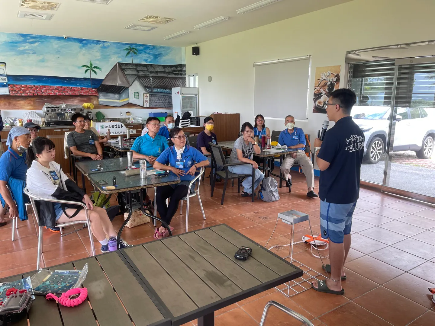
The course was scheduled for a full day, split into a morning lecture session and an afternoon of fieldwork at the intertidal zone followed by data processing. There were approximately 16 participants. The session opened with a warm introduction and applause from Ms. Chen Yi-Jun (affectionately known as "Shell Sister"), the host from the Taitung District Fishermen's Association. Spark and Coach A-Xian went first, introducing the concept of citizen science and walking participants through photography equipment. Watching them deliver polished, engaging presentations, I noticed how they would pause to ask questions, inviting participants to respond — a technique that created genuine back-and-forth interaction and helped break the ice.
Participants in the course didn't just listen attentively — they also took advantage of the breaks to share notes and exchange ideas with each other.
After his session, I pulled Spark aside to ask for tips. He grinned: "Just ask them what they hope to learn about intertidal surveys. Don't worry — if you get something wrong, we won't even know!!"
That made me think: "Right — instead of simply working through the slides from start to finish, why not open by chatting with them first? Ask about their own experiences in the intertidal zone. Make it feel like a conversation between friends." The moment I reframed it that way, the nerves and pressure melted away. I was still making frequent trips to the bathroom, though…
Time flew, and soon it was my turn. The moment I picked up the microphone, there was still a brief flash of hesitation — but I opened with why I had come, and the memory of visiting the Fushan intertidal zone ten years ago. I then asked the participants about their own volunteering experiences. That simple back-and-forth immediately dissolved the tension. From there, I gradually walked them through my thoughts on intertidal ecology, field survey methods, and hands-on experience, weaving in the little riddles that Cheng-Lu had tucked into the slides to keep everyone engaged. I also shared the kinds of things I notice and think about when observing intertidal life. The interaction with participants made me feel less like an instructor and more like a long-lost friend catching up. Before I knew it, I had worked through all the slides — right on schedule.
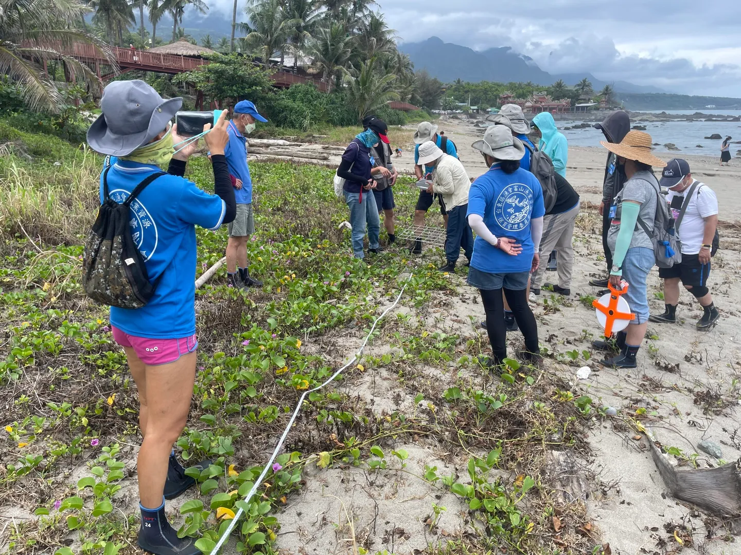
Leading participants to the intertidal zone and showing them firsthand how to conduct a survey.
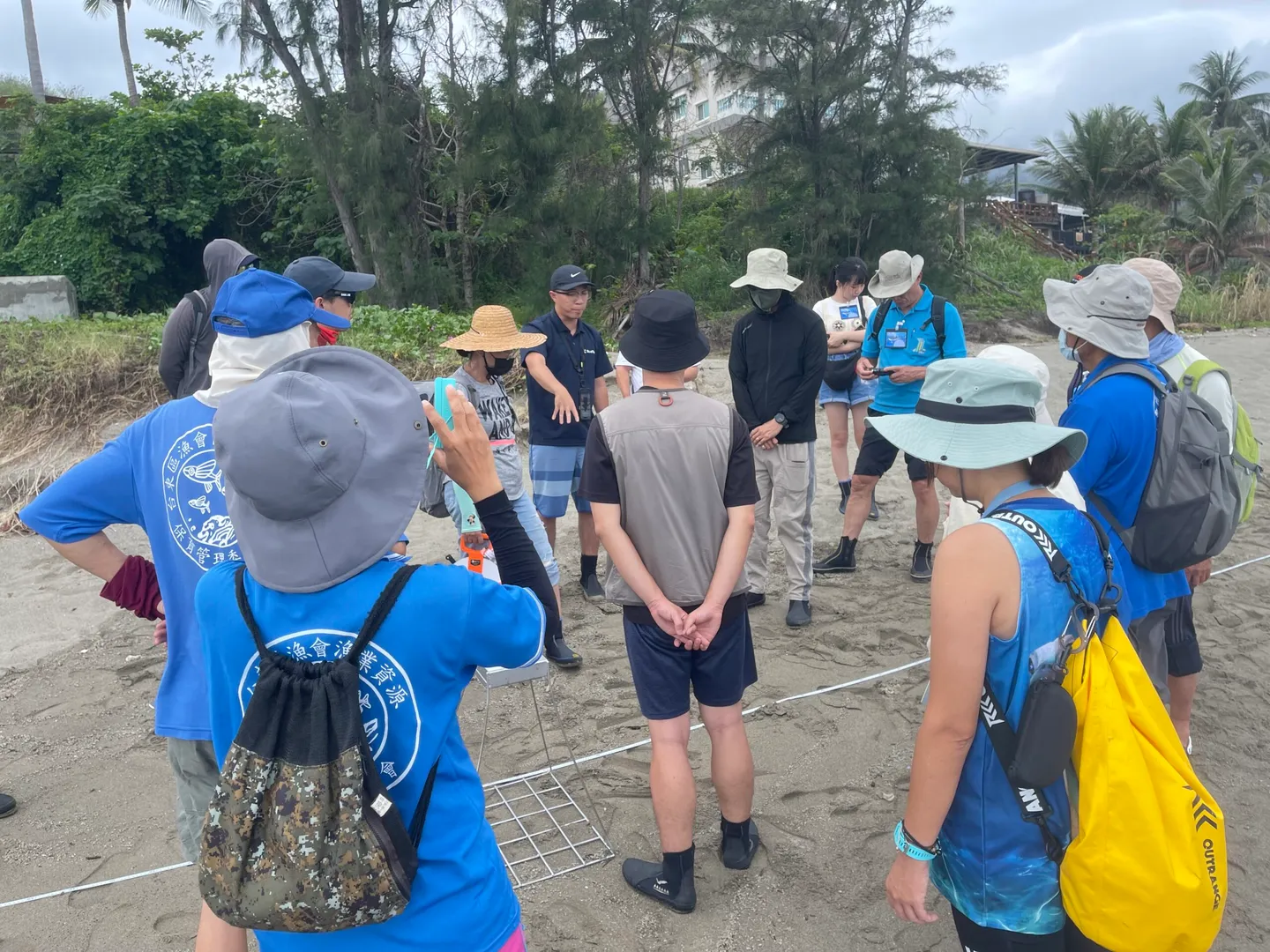
After lunch, the afternoon session moved to the intertidal zone for hands-on practice with survey methods and underwater photography. The tides, weather, and wave conditions were unfavorable that day (a typhoon was nearby), so we kept to the beach and started from the basics: how to lay out a transect line and use a quadrat frame. Participants were enthusiastic and raised all kinds of questions about planning and setting up transect lines. I took that as a good sign — it suggested the morning's content had sunk in and sparked genuine thinking. If participants had simply followed instructions without questioning, it would have been nothing more than a hands-on activity, not an experiment — and that's not what citizen science is about.
The transect line and quadrat frame — two of the essential tools for any intertidal survey!
As the tide gradually receded, we spread out across the Fushan conservation area to search for intertidal life. Walking along the shoreline, I was struck by the richness of the terrain: sandy beach to the south, large rounded cobblestones further north, scattered igneous rock outcrops forming a lagoon-like topography, and at the northernmost end, a concrete drainage outlet and seawall. While I was on the lookout for organisms for participants to photograph, I was also mentally mapping the terrain, chatting with them about how I might design a survey if I were to study this site. The reaction suggested everyone was still a bit confused — so I switched gears and let participants focus on finding and photographing intertidal life. The assignment: photograph at least 10 different species before heading back!
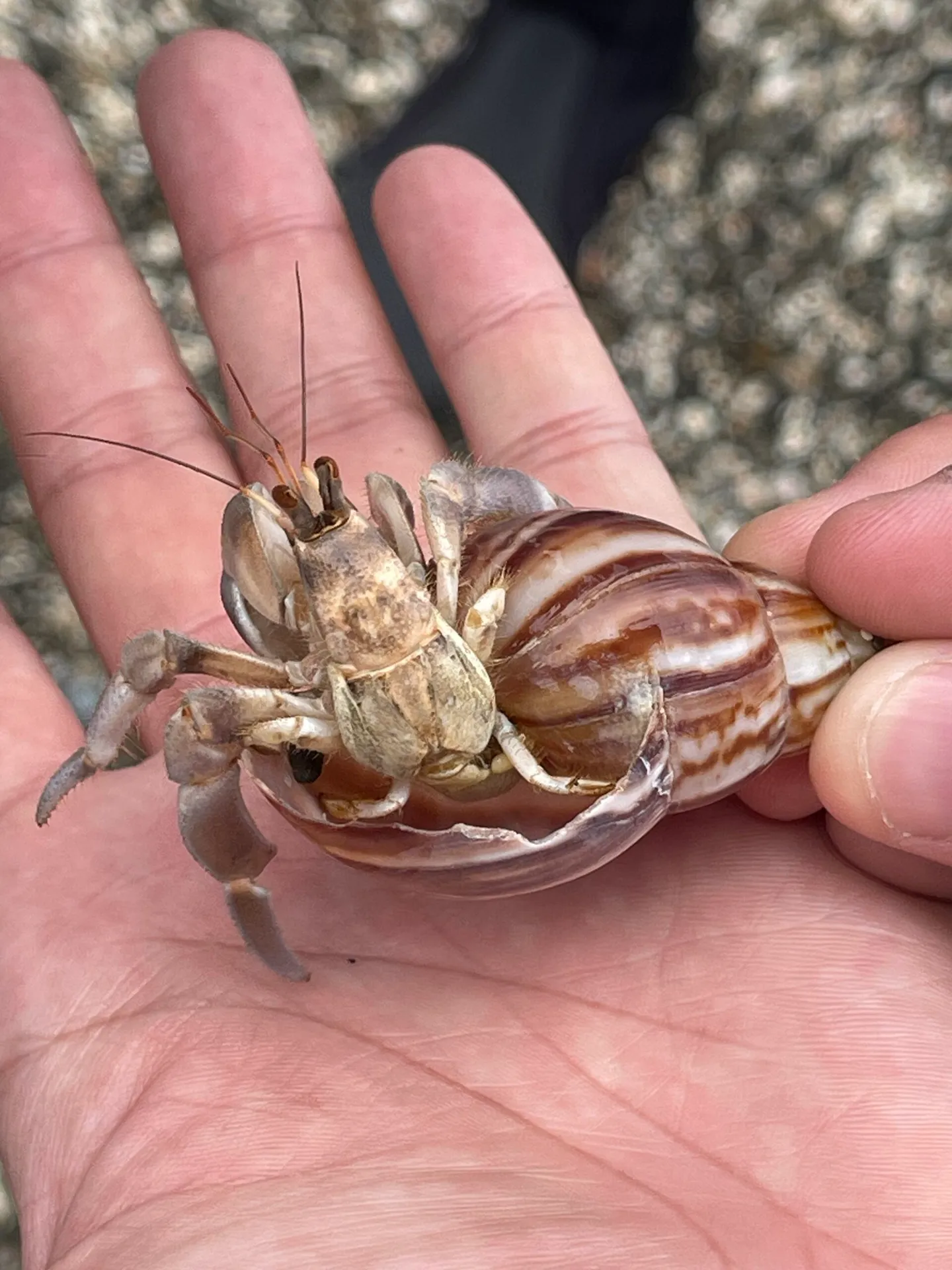
There's always a curious little creature poking its head out to say hello.
In the final stage of the course, we returned indoors to organize and upload the day's photos to the cloud, then reviewed how to handle the data collected during the afternoon transect survey. I believe this is the most critical part of any citizen scientist training. To function as a citizen scientist, you need a basic ability to organize data and understand what it actually means. As participants began working through the numbers, I could see them concentrating hard — but also swimming in question marks. They asked plenty of questions and were eager to make sense of it all. I did my best to break it down visually with simple diagrams and explanations, guiding them away from getting stuck in a single survey framework. I wasn't sure whether everyone fully grasped it then and there, but I figured that having the concept now would be enough — when they eventually try conducting their own surveys, true understanding will follow naturally.
At the end of the day, one participant turned to me and said: "You said this was your first time teaching?"
"That's right," I replied. "I've never done this before."
"You came across so naturally and vividly," they said. "I would have thought you were a seasoned instructor!!"
Getting positive feedback from participants — that must be the greatest reward of being an instructor.
Reflections
This was my first time stepping into the role of an instructor, and I consider it an incredibly rare and valuable experience. What I took away most is that teaching can be reframed as storytelling — sharing the experiences and ideas accumulated through years of study and work with a group of friends, while making it interactive and keeping the energy alive. When delivered in an engaging way, participants absorb far more. And the volume of content or the precision of knowledge, I've come to believe, is not the most critical point. In an age of information abundance where anyone can look anything up online, what matters more is teaching people how to use knowledge — how to think about problems scientifically, and how to discuss ecological issues using scientific reasoning. That is what truly embodies the spirit of citizen science. Most important of all is encouraging participants to start collecting data and building the habit of planning long-term surveys — because that, in the end, is one of the greatest contributions anyone can make to conservation.
My deepest thanks to Cheng-Lu for the referral, to Spark and A-Xian at BlueTrend for their tremendous support, and to Shell Sister for organizing this event — it brought me back to the very place where I once did my graduate research, and let me witness the changes along the East Coast and the vitality of the local community.
